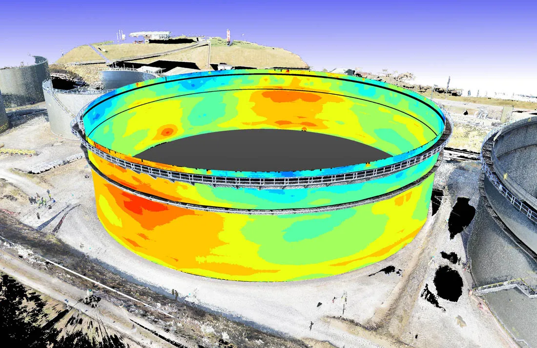
3D Laser Scanning for Storage Tank Calibration
3D laser scanning is a modern surveying technology that captures millions of precise measurement points from s…
Read Article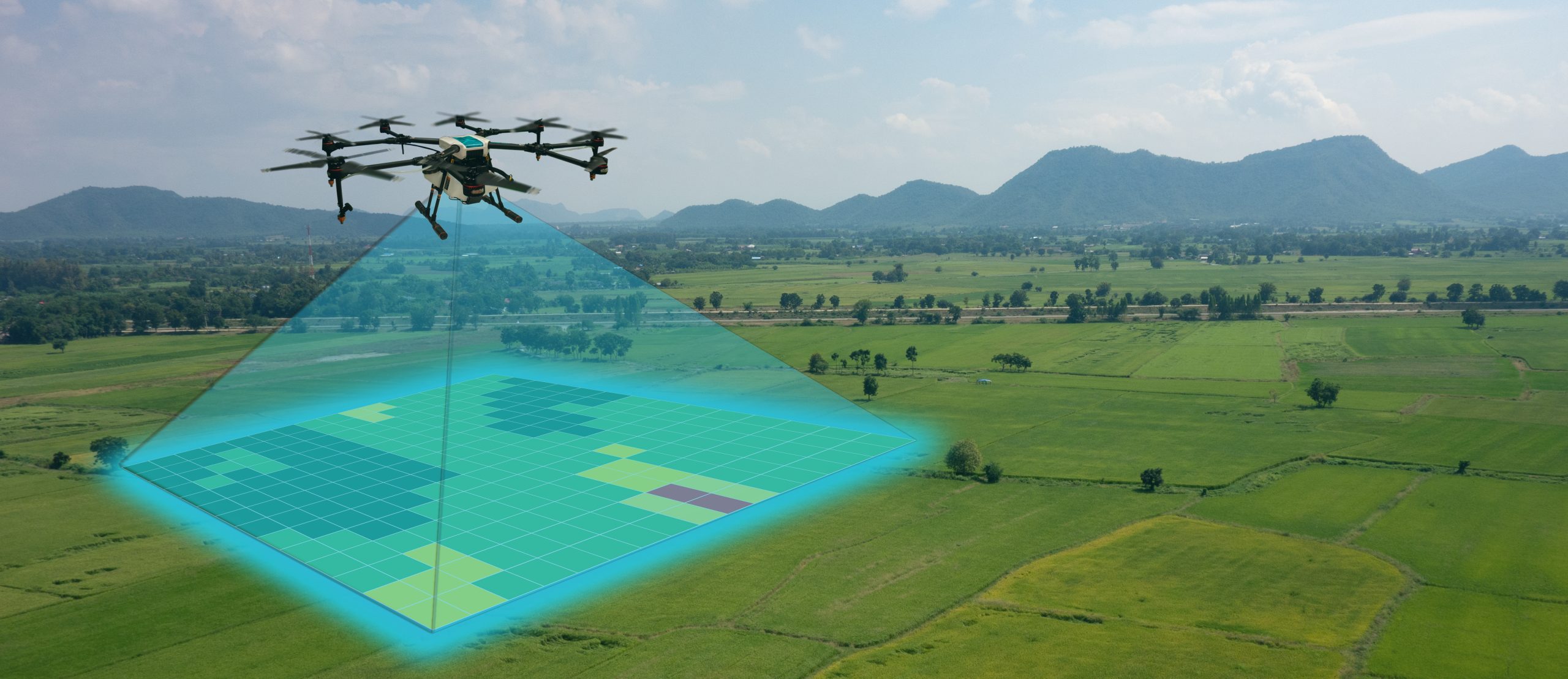
UAV / Drone Surveying & Mapping
Drone surveying involves flying a UAV over a site using a planned flight path to capture overlapping aerial im…
Read Article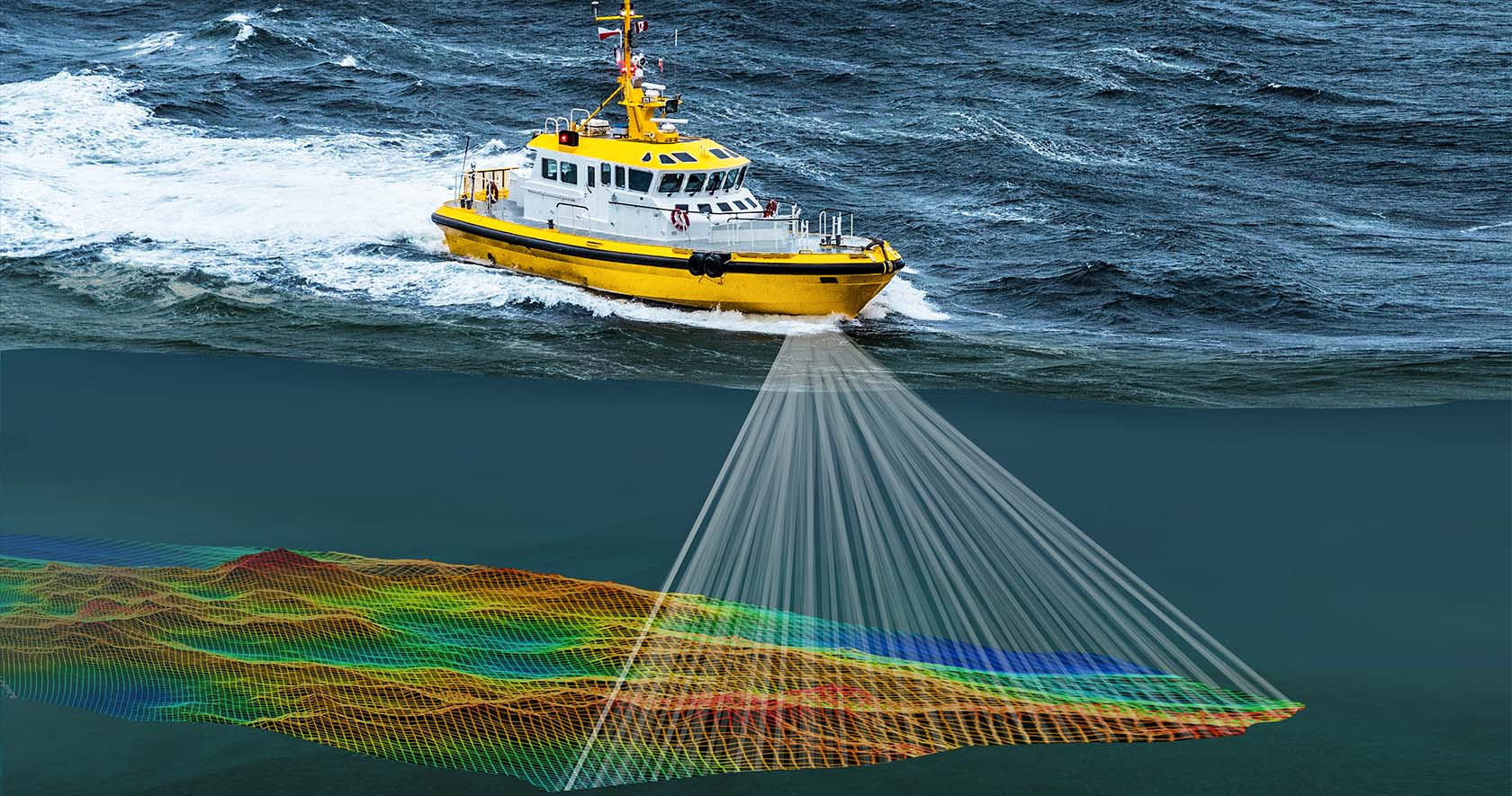
Beneath the Surface: A Guide to Hydrographic Surveying
Outlining the different types of hydrographic surveys…
Read Article