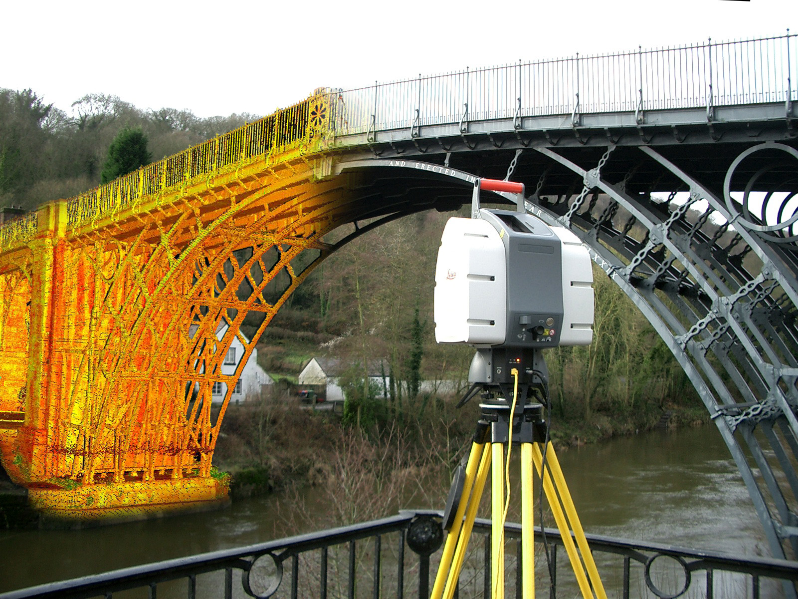
High-density point-cloud scanning for structures, storage tanks and digital twin creation.
Optimum Geospatial Ltd offers advanced 3D Laser Scanning and LiDAR Scanning services that capture real-world environments with exceptional speed, accuracy, and detail. Using high-precision terrestrial scanners, mobile mapping systems, drone-based LiDAR, and professional data processing workflows, the company transforms physical spaces into intelligent digital models for planning, design, construction, operations, and asset management.
Our scanning solutions are ideal for buildings, factories, plants, roads, bridges, power facilities, mines, storage tanks, land parcels, and complex infrastructure where accurate measurements are critical. Millions of spatial data points are collected to generate point clouds, 2D drawings, topographic maps, 3D CAD models, BIM-ready files, and digital twins that improve decision-making while reducing costly site errors and rework.
For architects, engineers, developers, surveyors, and facility managers, 3D scanning enables rapid as-built documentation, deformation monitoring, progress verification, clash detection, volumetric calculations, and retrofit planning with minimal disruption to ongoing operations. LiDAR is especially effective for large terrain mapping, corridor surveys, forestry, and inaccessible locations.
With a strong geospatial background and commitment to quality, Optimum Geospatial Ltd delivers reliable scanning solutions across Kenya and the wider African region. Whether for a single structure or a multi-site industrial project, we provide accurate data you can confidently build, manage, and plan from.
Professional land boundary and ownership surveys for legal and development purposes.
Precision surveys supporting infrastructure design, construction and monitoring.
Comprehensive GIS data collection, analysis, visualisation and custom application development.