Underwater topographic surveys for waterway infrastructure and resource management.
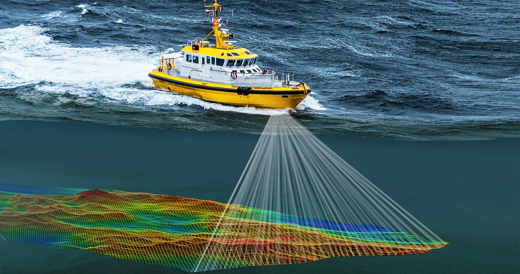
Optimum Geospatial Ltd offers professional Hydrographic / Bathymetric Survey services for measuring water depths, mapping underwater terrain, and delivering accurate data for marine, inland water, and engineering applications. These surveys are essential for understanding submerged environments and supporting safe, efficient planning and operations.
We conduct surveys on lakes, rivers, dams, reservoirs, canals, ponds, ports, harbors, wetlands, and coastal zones using modern echo sounders, GNSS positioning systems, survey boats, drones, and advanced geospatial software. Our integrated approach ensures precise positioning and dependable depth measurements even in challenging environments.
Survey outputs include bathymetric maps, contour plans, underwater digital terrain models, cross-sections, storage capacity studies, sedimentation analysis, dredging volume calculations, shoreline mapping, and comparative change surveys over time. These deliverables are valuable for water resource management, dam safety assessments, irrigation planning, bridge and culvert studies, navigation channel maintenance, flood modelling, intake and outfall design, and environmental monitoring.
Hydrographic and bathymetric surveys help reveal conditions below the water surface that cannot be observed visually, reducing uncertainty and improving engineering decisions. With strong technical expertise and commitment to quality, Optimum Geospatial Ltd serves clients across Kenya and the wider African region. Whether for a small reservoir, river crossing, dredging project, or major infrastructure development, we provide reliable data that supports safe, efficient, and sustainable project delivery.
Professional land boundary and ownership surveys for legal and development purposes.
Precision surveys supporting infrastructure design, construction and monitoring.
Comprehensive GIS data collection, analysis, visualisation and custom application development.