AV (Unmanned Aerial Vehicle), commonly known as drone surveying, has revolutionized the way land, infrastructure, and environmental data are captured. By combining advanced drone platforms with high-resolution cameras, GPS technology, and specialized mapping software, drone surveys provide fast, accurate, and cost-effective spatial data for projects of all sizes. From construction sites to agricultural land and mining operations, UAV mapping is now an essential tool for modern planning and decision-making.
What is UAV / Drone Surveying?
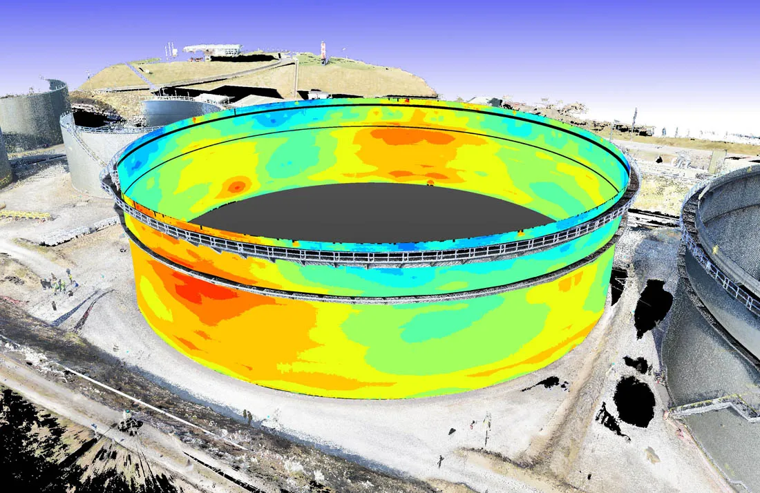
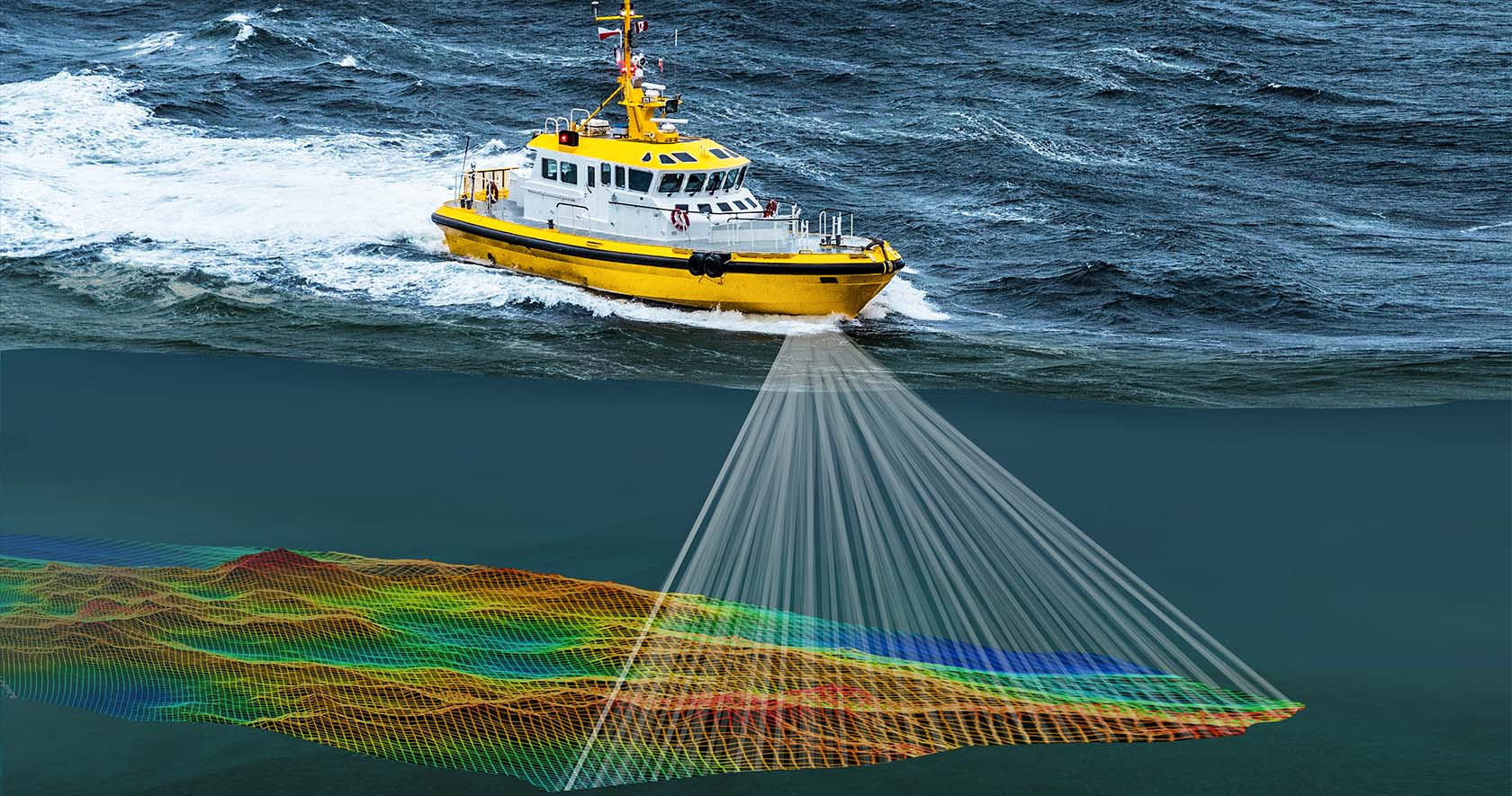
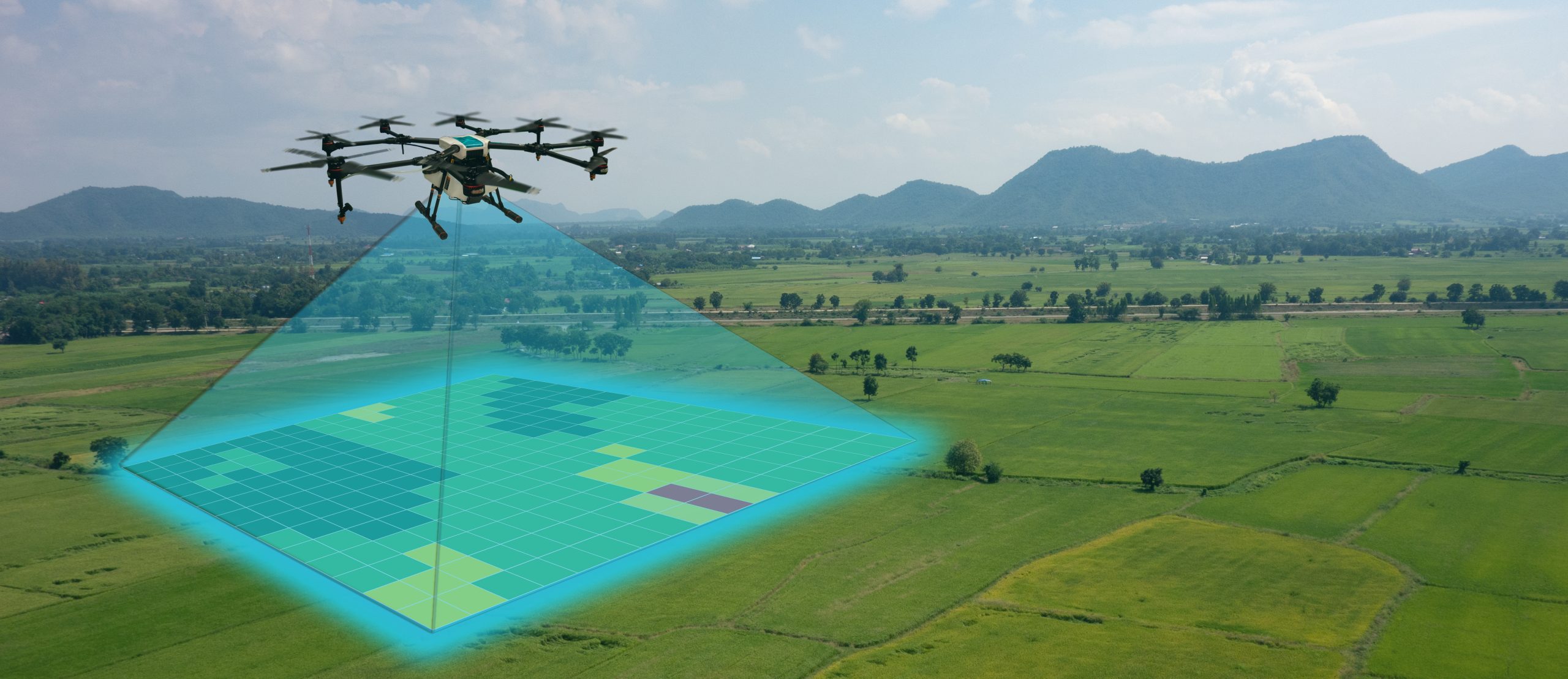
Drone surveying involves flying a UAV over a site using a planned flight path to capture overlapping aerial images or sensor data. These images are then processed using photogrammetry software to create accurate maps, orthophotos, 3D terrain models, contours, and volumetric reports.
Unlike traditional ground surveys alone, drones can cover large areas quickly while collecting detailed data from above. This makes them ideal for locations that are difficult, hazardous, or time-consuming to access manually.
Key Benefits of UAV / Drone Mapping
1. Fast Data Collection
Drones can survey large areas in a fraction of the time required by conventional methods. Projects that once took days can often be completed in hours.
2. High Accuracy
When combined with Ground Control Points (GCPs) and RTK/PPK technology, drone surveys deliver highly accurate mapping outputs suitable for engineering and planning applications.
3. Cost Effective
Drone surveying reduces labor, field time, and equipment requirements, making it a cost-efficient solution for many projects.
4. Improved Safety
UAVs can safely capture data in hazardous areas such as quarries, steep slopes, busy highways, rooftops, or flood zones without exposing personnel to unnecessary risk.
5. Rich Visual Data
Drone outputs provide not only measurements but also detailed imagery that helps clients visualize sites and monitor progress.
Typical Deliverables
A professional UAV survey project may include:
- Orthophoto maps
- Topographic surveys
- Digital Elevation Models (DEM)
- Digital Surface Models (DSM)
- Contour maps
- 3D site models
- Volume calculations (stockpiles, excavation, landfill)
- Construction progress reports
- Inspection imagery and videos
Industries That Benefit
Construction & Engineering
Track project progress, calculate cut-and-fill volumes, and monitor site development.
Real Estate & Planning
Create aerial site presentations, land development plans, and marketing visuals.
Mining & Quarrying
Measure stockpiles, pits, and operational changes quickly and safely.
Agriculture
Assess crop health, irrigation planning, and farm management.
Utilities & Infrastructure
Inspect roads, railways, powerlines, pipelines, and drainage networks.
Environmental Management
Monitor forests, wetlands, erosion, and land-use changes.
Why Choose Optimum Geospatial Ltd
At Optimum Geospatial Ltd, we provide professional UAV / Drone Survey & Mapping services across Kenya and Africa using modern drone platforms, accurate positioning systems, and advanced processing software. Our team delivers reliable geospatial data that supports planning, engineering, monitoring, and informed decision-making.